

Shoreline in the Kittyhawk Group (click on any of the photos to enlarge)
Two days after we left Philip Inlet last June, we reached our second “new-to-us” anchorage – a secluded little hurricane hole in the Kittyhawk Group of islands in the Hakai Recreation Area.
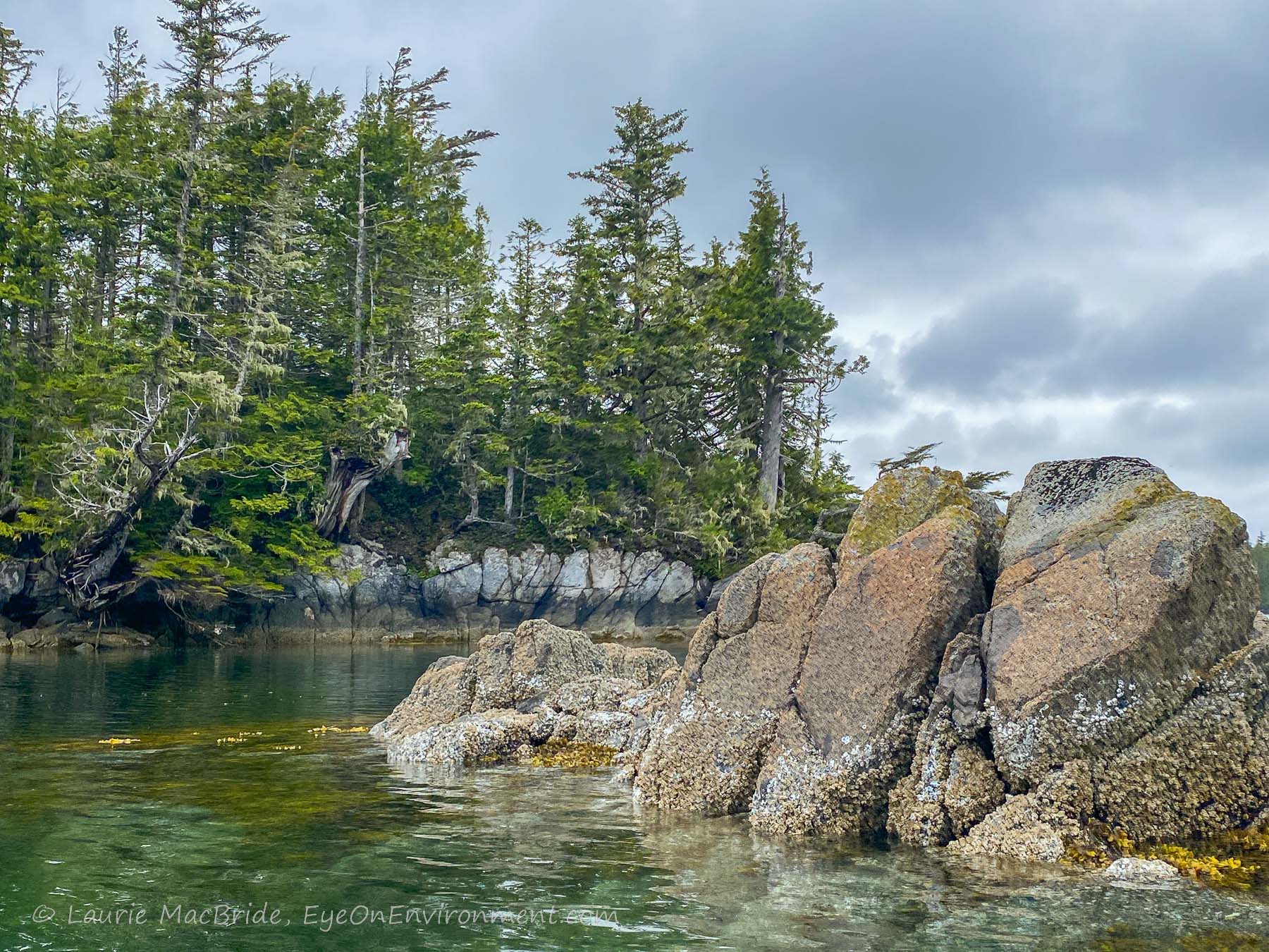
The spot we’d chosen was guarded by an even narrower entrance than at Philip. Luckily it was low tide when we entered, so the rocks and reefs were at least partially visible. This was helpful, since the maze of islets and narrow passages leading in and out of the anchorage was confusing for first-timers who’d yet to get their bearings.
We dropped the hook – carefully – in a small pool, surrounded by rugged little islets, rocks and reefs.
When we’re underway or anchoring for the night, we keep a keen and constant eye on our chart, always trying to keep well away from boat-eating rocks like this – the kind that often lurk just below the surface at higher tides.
But once we’re safely moored and it’s time to launch the kayaks, those same rocks and reefs turn into compelling destinations.

Interesting how our perspective changes, once we’re down at water level in our little paddle-powered vessels: the rocks and reefs seem even bigger close-up, but they’re no longer worrisome – instead they are utterly fascinating, and exactly where we want to be.
Discover more from Eye on Environment
Subscribe to get the latest posts sent to your email.


So true!
So lovely! Yes, I know what you mean about getting closer to the water. Although we never had kayaks, we always had many great dinghies to row around in – and some of the most precious finds were in places where our large boat could not meander through. What type of vessel do you have to get to these destinations? I’d love to take the Sea Turtle sailboat into BC waters one day!
Thanks for writing, Connie. Ours is a power boat, an older model, European displacement cruiser – slow, but built for the North Sea (i.e. built like a tank). There have been more than a few times when we’ve been very glad of that. 🙂
That’s great, very wise, too! Our sailboat also has auxiliary power but she’s so big that I’m not sure I could get her too close to those gorgeous areas you visit (she’s 40′ x 13′ and draws 5′). She’s also built like a tank… 🙂
Did you notice in that area that all the islands bear the name of a WWII military aircraft?
Indeed – Spitfire Island (and Channel), Hurricane, Kittyhawk, Typhoon, Lancaster…. The first year we went up that way we travelled with the big, thick Raincoast book on the origins of BC place names, and had it out in the wheelhouse all the time. The WW2 names seem odd when anchored in a calm spot like we were – perhaps more apt though once you head out Fulton Channel to round Superstition Point. Those waters can put up a fierce fight!
I’ve always thought that Shearwater should have been built at the head of Pruth Bay. There’s three miles of sheltered runway for the seaplanes. But…that’s military intelligence.
F