

Footsteps in Time
Today I’m revisiting a place I wrote about in a previous post, the ghost town of Ocean Falls (more photos below). Nestled against the mountains of Cousins Inlet on BC’s Central Coast, it’s a town that lives up to its name: with 172 inches/year of rain, it’s no wonder the 50 hardy year-round residents of Ocean Falls and adjacent Martin Valley call themselves The Rain People.
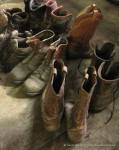
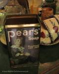
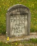
History is everywhere in Ocean Falls, covering the place like the fine dust on the boots in the photo above – one of hundreds of exhibits in the eclectic museum that one man has created above the old shipyard.
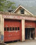
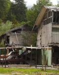
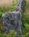
After the pulp and paper mill closed for the final time in 1980 and the town was written off by the government, a few determined residents managed to save part of the townsite from the wrecking crews. Among the “survivors” were the Martin Inn – once the largest hotel north of San Francisco – along with the firehall, ambulance station, high school, a large apartment building and a number of homes.
But they’re all pretty much in ruins. The paved roads of the townsite are travelled mainly by deer these days, who browse amid the deserted buildings and remnants of a once-thriving city of 5000 people. Each year brings the forest’s edge a bit closer.
But along the waterfront, however, there’s still life in Ocean Falls. The harbour authority provides sturdy and well-maintained docks for visiting boaters, and the lodge and the gift shop welcome tourists. The church and its garden are carefully tended by local volunteers. The post office is open for business, and the courthouse (complete with its old jail cells) has a new lease on life as home to the local improvement authority and public library.
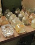
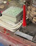
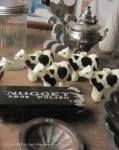
And of course there’s the museum, occupying the top floor of the old shipyard. Curator “Nearly Normal” Norman Brown spent years sifting through the town’s ruins, unearthing a veritable treasure trove from the detritus of decades of everyday life: objects of work, play, commerce and household life. Collectively – and more eloquently than words could ever do – they illustrate the history of Ocean Falls and honour the thousands of people who lived here over the years.
More photos from Norman’s museum, Ocean Falls townsite & Martin Valley. (Click on any image to launch the gallery viewer with larger versions of the images.)
-

- Museum Dancers
-
- Bric-a-brac
-
- Bric-a-Brac #2
-
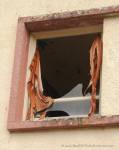
- Broken Lives (Martin Inn)
-
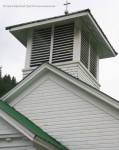
- Steeple
-
- Forever Young
")
")


")
 Coastal Fusion, © Laurie MacBride


")


